East Zion and Bryce Canyon
Leaving Zion, we head East through a branch canyon, then north to Bryce Canyon National Park. After Bryce, we drive Northeast along routes 12 and 24 through Escalante and Capitol Reef National Parks, enroute to Moab, Utah, and Arches National Park.
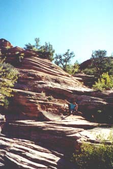
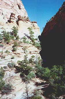
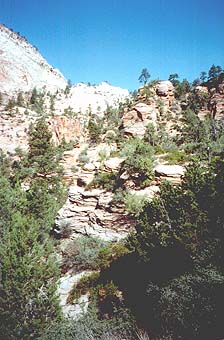
The main canyon at Zion runs roughly north - south.
There is a branch canyon running east, accessible through a long tunnel
built in the 1930s. This country is much drier, but the sandstone strata
are more pronounced.
Below are more views from the road leaving east Zion.
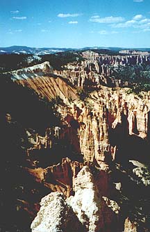
Bryce canyon is much higher in altitude, so ice
becomes a large factor in eroding the landscape. Water tends to percolate
down through the sandstone, pooling in the cracks created by faulting.
Then during the 9-month winters here, it freezes and cracks the rock into
vertical slices and pillars.
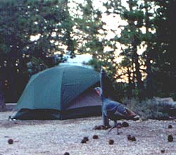
Wild turkeys in northern California are generally
very people-shy. But in the campground at Bryce, they come around at
sunset to beg for handouts from the campers. This tom was accompanied
by three hens ... but hey, this is Mormon Utah after all.
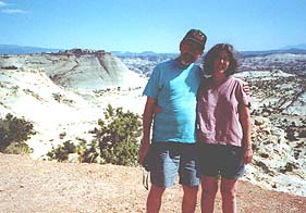
Alison and John at a roadside rest stop just outside of Bryce. A very helpful German tourist took this picture, and we returned the favor often. European tourists easily outnumbered Americans: French, British, but most of all, Germans. Signs in shops are often bilingual English / German. Temperature and distance are signed in both English and metric.
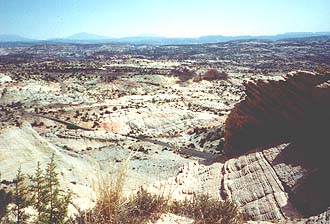
Another view North from Route 12, a scenic highway in
Utah that links Zion and Bryce with Escalante National Park. Thanks to a
very poor guidebook, we didn't plan any stays at Escalante, or Capitol
Reef National Park further North.
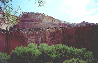
A piece of canyon wall in Capitol Reef, with fruit
trees along the Fremont River in the foreground. There are some very old
petroglyphs here, done by the Native Americans who farmed here centuries
ago.